


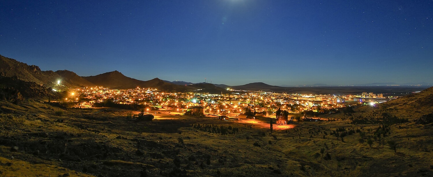
Before we mention the history of Sivrihisar, let’s get to know Sivrihisar a little; Sivrihisar is the largest district of Eskisehir. The district centre is on the intersection of Ankara, Eskişehir and İzmir highways. It stands out with its pointed cliffs rising towards the sky on the edge of a volcanic rock mass, which is the extension of Mountain Çal. The district was named after these cliffs. At the Hisarönü-Balkayasi location of the cliffs, the Eskişehir Archeology Museum Directorate found a painted rock picture. Scene of horse, human and dog figures are painted on the rock surface painted in red.
Sivrihisar is the biggest district of Eskişehir, while taking firm steps forward on the way of being a brand city in tourism. It stands out with its pointed cliffs rising towards the sky on the edge of a volcanic rock mass, which is the extension of Mountain Çal. The district is on the intersection of Ankara, İzmir and Eskişehir highways. Sivrihisar is located 100 km, 135 km, 120 km, 448 km, 427 km and 520 km away from Eskişehir, Ankara, Afyonkarahisar, İzmir and Çanakkale, respectively.
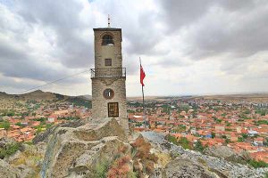
SİVRİHİSAR is an undiscovered tourism city with original architectural texture, historical artifacts, notable natives, cultural values, outdoor sports, natural and wild life, flora and fauna including endemic species as well as being the Centre of Earth which is suggested by the Nasreddin Hodja. Sivrihisar, while attracting attention of the visitors with its many heritages, which have taken over from the Phrygians, Romans, Seljuks and Ottomans at the crossing point of historical roads, will give the feeling of the time has frozen in Pessinuss, where the famous royal road passes and the Cybele temple is located, Balıkdamı Bird Paradise, where birds from the three continents stop, Armenian Church Surp Yerortuyun, which Anatolia’s second largest church, and in tens of historic mosques, fountains, Turkish baths and old streets, especially the Great Mosque with Anatolia’s largest wooden pillars.
Sivrihisar, with pearl earring, a cebe, and five-chimney rug, carries the characteristics of a rich culinary culture due to being a place visited by various civilizations for centuries.
Sivrihisar is a stop-point for travelers, those who have fallen on the roads with the desire to explore, seeking fresh flavors, want to walk through the footsteps of history, and seeking peace.
- District Population: 21.265 (10.678 MEN 10.587 WOMEN) in the YEAR 2015
- Area: 2.987 km²
- Elevation: 856 m
- Coordinates: N 39° 26’ 23’’
E 31° 31’ 48’’
General Information
- Country: Turkey
- Region: Central Anatolia
- Province: Eskişehir
- Postal Code: 26600
- Area Code: 0222
- License Plate: 26
- DISTRICT has 78 neighborhoods.
- Elevation of the District center: 1.100m (3.609 ft)
- Annual Average Temperature is 10-120C.
The highest and lowest temperature values are observed as 39.1 C and -26.3 C.
Sivrihisar District is located in the Northwestern region of Central Anatolia. Sivrihisar neighbors to the geographical regions of Black Sea from the North, Marmara from the Northwest, and Aegean from the West and the South.
Although a large part of its land seems like flat, high mountains and rocks in places disturb the plain structure of the land. The most important heights are the Sivrihisar Mountains. The highest one of these mountains is the Mountain Çal. Other important mountains and hills are Arayıt Mountain, Boztepe, Büvelik Hill and Yediler Hills. Sakarya River is the main stream of our district.


